I. CHART INTERPRETATION
Part 1 :"Understanding a Chart"
A. Great Circles
B. Meridian (defined)
C. the Greenwich Meridian
D. Longitude and Latitude illustrated
E. Parallels of Latitude
F. the Mercator Projections
G. Charts Scales
1. large
2. small
3. coastal
II. CHART INTERPRETATION
Part 2: "Reading the Chart"
A. Selecting the right
chart
B. Sounding Datum
C. Color Scheme on Charts
D. Lettering on Charts
E. Symbols & Abbreviations (ref. to Chart Number
1)
III. CHART INTERPRETATION
Part 3: "Using the Chart"
A. the Meridian Grid
B. Arc Distance (the nautical mile)
C. Measuring Distance and Finding Position w/dividers
D. Determining Direction w/parallel rules
E. Scaling Distance on the Latitude Scale
IV. AIDS TO NAVIGATION
A. Illustrative
Examples of Lateral Systems of Navigation Aids
1. Intracoastal
Waterways
2. Great Lakes
3. Western Rivers
4. other areas of United States
B. Following
directions
1. Buoys
2. Cans
3. other markers
C. Navigation Aids by
Day and by Night
V. USEFUL KNOTS
15 valuable knots most
commonly used by boaters with step-by-step
instruction on how to tie them. Knots covered
include: Sheet Bend, Carrick Bend, Clove Hitch,
Rolling Hitch, Anchor Bend, Bowline, Bowline on a
Bight and many others. Also includes instructions as
to their use and how to treat the ends by searing or
whipping and then coiling for storage
VI. VISUAL DISTRESS
SIGNALS An explanation of the United States Coast Guard
Visual Distress Signal Law.
A. Requirements
B. Types of Signals
C. Pyrotechnics
1. smoke signals
2. flares
D. Signal Flags
E. Lights (and when to use them)
F. Safe handling techniques and Storage Methods
VII. CAPSIZING, SINKING
and FALLS OVERBOARD
This program deals
with the three major causes of loss of life in
pleasure boating, of which Capsizing is usually an
average of approximately 47% of annual fatalities.
Covered are the balancing of forces between buoyancy
and gravity and how this ratio affects the safe
operating level of freeboard and therefore the
stability of a vessel.
|
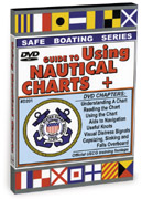
 How to Read, Use and Interpret Nautical Charts, plus segments on Visual Distress Signals, Useful Knots, Aids to Navigation and much, much more (see outline below). This Official USCG training footage was previously only available on 16 mm film rented from the U.S. Archives, but Magic Lamp now makes it available for all boaters on DVD. The knowledge from this program combined with the information contained in our 2-hour DVD
#301 on Coastal Piloting will give you the confidence to take your boat out, get to your location and return safely. Remember... the experienced sailor knows that the sea isn't his enemy... it's the hard stuff around the edges!