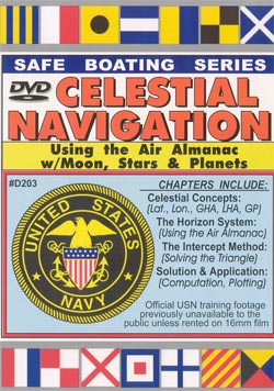
CELESTIAL NAVIGATION
Using the Air Almanac (H.O. 249)
Use the Horizon System and Intercept Method to shoot the 57 Navigational Stars, Sun, 4 Planets and Moon.
Navigate day or night
Item #203.........120 minutes

Basic Celestial NavigationUse the Horizon System and Intercept Method to shoot the 57 Navigational Stars, Sun, 4 Planets and Moon. Navigate day or night.
     In addition to this official USN footage (previously only available on 16mm film), the program contains a wonderful documentary prepared by the Dept. of Commerce and Geodetic Survey Division which traces man's progress in developing methods of accurate position determination. Running time: 2-hours.
     The information in this program assumes that you have some knowledge of how to use a sextant. If you would like a refresher course on Sextant Use, see our DVD #303 "Celestial Navigation, the Sun NoonShot". In that program, a former U.S. Naval Academy instructor fully covers how to adjust, use and read the sextant.
       
  Ordering Info    $34.95   

--- Complete DVD Table of Contents ---
 
Opening comments: by Gene Grossman, Magic Lamp skipper

I. Theory

A. History of Celestial Navigation theory
B. The Celestial Sphere

1. the Terrestrial Sphere
2. Great Circles
3. Prime Meridian
a. longitude
b. the equator
c. latitude

C. Arc distance: the Nautical Mile

1. Parallels of Latitude
2. Celestial North and South Pole
3. the Prime Celestial Meridians
4. Declination
5. Zenith, Geographic Position
6. Hour Angles, GHA, LHA, SHA, the Nautical Almanac
7. the Prime Hour Circle (first point of Aries), GHA Aries, SHA

II. THE HORIZON SYSTEM

A. the Celestial Horizon
B. Vertical Circles
C. Altitude, Declination, Ho, Hs

1. co-altitude (Zenith distance)
2. circle of equal altitude
3. the Circle of Position

D. Summary of Horizon System
E. the Air Almanac

III. THE INTERCEPT METHOD

A. Linear distance: the Line of Position
B. GHA and Declination in the Air Almanac
C. Celestial Line of Position

1. Ho, Hs and Assumed Position
2. Actual Line of Position -vs- Assumed Line of Position 3. Solving the Celestial Triangle

a. Local Hour Angle (LHA) of the celestial body
b. using HO 249 Sight Reduction tables
c. using the Plotting Sheet 4. A Positive Fix

IV: SOLUTION and PRACTICAL APPLICATION

A. Using the Sextant, Timepiece and HO 249

1. computation
2. observation
3. plotting

B. Filling out the Sight Form
C. Using the Nautical Almanac, Air Almanac and Sighting
D. Practical Example carried all the way through

V. DOCUMENTARY: "Pathfinders From the Stars" A fascinating, colorful project that traces man’s progress in methods of accurate position determination on land, sea and in the air, from the ancient Polynesian stickchart to the development of the compass, sextant, geodometer and satellite triangulation system.