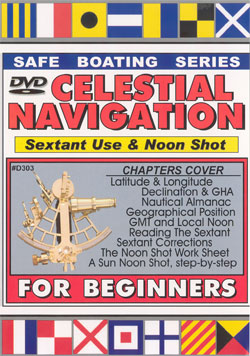
| I. INTRODUCTION: 2 JERKS
IN A POWERBOAT GETTING LOST II. 10-min. REVIEW OF COASTAL PILOTING (In
Sight Of Land)
A. Direction &
Distance from a known point
1. Landmarks (on
land)
2. Celestial bodies
B. History of the
Compass (in Magnesia, centuries ago)
C. The Compass Card: 360 degrees around (& the
lubber line)
D. Within Sight Of Land:
1. Relative and
Reciprocal Bearings
2. Triangulation between 2 landmarks (2-Bearing
Fix)
3. Using Dividers to locate Lat. & Long. of
fix
4. Using the Nautical Mile scale on the chart
5. Difference between Nautical Mile and Statute
Mile [Each Nautical Mile=One Minute (1/60th) of a
Degree]
III. LECTURE 1.:
INTRODUCTION TO CELESTIAL NAVIGATION
A. The GP
(Geographical Position, or "Ground Point")
B. the Equator and the Greenwich Meridian
C. Parallels of Latitude (0 to 90 degrees North or
South)
D. Meridians of Longitude (0 to 180 degrees E or 180
W)
E. Declination (same measurement as Latitude)
F. Greenwich Hour Angle (GHA) (0 to 360 degrees
around)
IV. THE NAUTICAL ALMANAC:
GP of all Navigational Celestial Bodies for each second
of time
V. DETERMINING BOAT'S
DISTANCE FROM A CELESTIAL BODY's GP
Boat's Zenith: line
straight up from center of earth through the boat
VI. WHAT THE SEXTANT
MEASURES (it's all done with mirrors)
A. Using the Horizon
to Determine reciprocal Zenith Distance (from boat's
perpendicular to the celestial body)
B. Bringing the celestial body down to earth
C. Reading a Sextant's vernier scale (some examples
shown)
VII. SEXTANT CORRECTIONS
ON THE WORKSHEET
A. INDEX Correction
(IC): errors ON the arc and OFF the arc
B. DIP: height of eye above sea level at time of
sighting
C. LIMB: for Sunshots - upper limb or lower limb
being shot
D. REFRACTION CORRECTION: accounts for bent light
rays
E. PARALLAX CORRECTION (used mainly for Moonshoots)
VIII. TIME: Corrections on
the Worksheet for Greenwich Mean Time
A. Elimination of the
Worksheet's Time Corrections
1.maintain
accurate quartz watch set to GMT 24-hr. time
2.WWV radio signals for daily settings to UTC
time-beeps
3.universal time coordinated (UTC)
B. Sunspeed: 15
degrees(900 nautical miles) per hour
C. Marking the Time of the Sextant shot
IX. DEFINITION OF THE
MERIDIAN CROSSING
A."High
NOON"
B.Shot to determine Latitude & Longitude at Local
Apparent Noon (LAN)
X. THE NAVIGATIONAL
TRIANGLE: how it is solved by the tables
-----------END
OF FIRST HOUR-----------
XI. SECOND LECTURE: PAUL
MILLER, former USNA instructor "LATITUDE &
LONGITUDE AT NOON: THE NOONSHOT" [Noonshot Worksheet
is proved to all video purchasers]
A. TAKING A NOONSHOT
and filling in the Worksheet
B. WATCH TIME LAN portion of the Worksheet
LINE 1: Date of
shot being taken
LINE 2: entering the NOON DR Latitude
LINE 3: NOON DR Longitude (Great Circle, defined)
LINE 4: The Time ZONE CENTER: GMT
LINE 5: DISTANCE FROM ZONE CENTER
LINE 6: Using Nautical Almanac: time of Meridian
Pass.
LINE 7: Time to MERIDIAN PASSAGE from Zone time
NOON
LINE 8: LOCAL WATCH TIME OF GMT LAN C. Time
Notations for DECLINATION Section of Worksheet
LINE 9: Declination Time
LINE 10: Time Zone Description
LINE 11: Insertion of GMT of Meridian Passage
LINE 12: Declination at GMT of Meridian Passage
XII. USING THE SEXTANT TO
TAKE A NOONSHOT
A. How to USE the
Sextant: parts of sextant displayed
B. How to READ the Sextant: vernier, micrometer drum
C. Sextant Corrections on the Noonshot Worksheet
LINE 13:
"hs" Raw sextant reading (sextant
height)
LINE 14: Index Correction: zeroing out the
mirrors
LINE 15: "dip" Correction: height of
eye above seawater
LINE 16: Apparent Altitude: corrected for Index
& Dip
LINE 17: Limb correction (for portion of body
sighted)
LINE 18: other corrections (parallax, refraction,
temp.)
LINE 19: "HO" totally corrected sextant
reading of alt.
XIII. ZENITH DISTANCE
(defined and illustrated)
LINE 20: standard
amount pre-filled in on worksheet
LINE 21: subtraction of HO from Line 19
LINE 22: Zenith Distance determined
XIV. LATITUDE CASES 1
& 2 (depending on location re geography)
A. Cases 1 & 2
LINE 23:
Declination (greater or less than DR latitude)
LINE 24: Figuring in the Zenith Distance
LINE 25: Actual LATITUDE figured out
B: Case 3 (if
geography dictates)
LINES 26, 27, 28
XV. LONGITUDE
LINE 29: Averaging
of times to calculate LAN crossing
LINE 30: Taking ZONE DESCRIPTION (from GMT) into
account
LINE 31: Exact GMT of LAN (Meridian Crossing
time)
LINE 32: Finding GMT GHA (longitude) of sun at
crossing
LINE 33: Nautical Almanac data entry for time
interpol.
LINE 34: Corrected entry for Longitude of LAN
crossing
LINE 35: Final computation of LONGITUDE
XVI. THE PLOTTING SHEET
Using Lat. & Long. information from LINES 25 & 35
XVII. FINALE (more tips on
how to actually use the SEXTANT)
A. SEXTANT Adjusting
to eliminate errors: using filters
B. Listening to the time beeps on a short-wave radio
C. The artificial Horizon (if real one not available)
D. "Rocking the Sextant" for a more
accurate shot
|
 Two complete 1-hr. lectures: Gene Grossman
(Magic Lamp's Skipper) does lecture #1 on theory and the
how to use the Nautical Almanac. Paul Miller (former U.S.
Naval Academy Instructor) does lecture #2 on how to use a
Sextant and then shows the complete taking of a Sun
Noonshot, filling in each line of the worksheet for you.
Free Worksheet included.